
Easier access to scientific data
Brought to you by NOAA NMFS SWFSC ERD
|
ERDDAP
Easier access to scientific data |
Brought to you by NOAA NMFS SWFSC ERD |
| Row Type | Variable Name | Attribute Name | Data Type | Value |
|---|---|---|---|---|
| attribute | NC_GLOBAL | acknowledgment | String | Buoys operated by the University of Maine Physical Oceanography Group (PhOG) are funded in part through the National Oceanic and Atmospheric Administration (NOAA) as a Regional Association within the U.S. Integrated Ocean Observing System (IOOS). |
| attribute | NC_GLOBAL | breakout_id | int | 4 |
| attribute | NC_GLOBAL | buffer_type | String | sbe37 |
| attribute | NC_GLOBAL | cdm_data_type | String | TimeSeries |
| attribute | NC_GLOBAL | cdm_timeseries_variables | String | station, longitude, latitude, depth |
| attribute | NC_GLOBAL | clock_time | String | Center of period |
| attribute | NC_GLOBAL | comment | String | University of Maine, Physical Oceanography Group |
| attribute | NC_GLOBAL | contact | String | um_phog_dmac at umeoce.maine.edu |
| attribute | NC_GLOBAL | contributor_email | String | info@neracoos.org,info@gmri.org |
| attribute | NC_GLOBAL | contributor_name | String | NERACOOS,Gulf of Maine Research Institute |
| attribute | NC_GLOBAL | contributor_role | String | funder,distributor |
| attribute | NC_GLOBAL | contributor_role_vocabulary | String | https://vocab.nerc.ac.uk/collection/G04/current/
|
| attribute | NC_GLOBAL | contributor_url | String | http://neracoos.org,http://www.gmri.org
|
| attribute | NC_GLOBAL | Conventions | String | CF-1.8,ACDD-1.3,IOOS-1.2 |
| attribute | NC_GLOBAL | creator_address | String | 101 MacKay Lab |
| attribute | NC_GLOBAL | creator_city | String | Orono |
| attribute | NC_GLOBAL | creator_country | String | USA |
| attribute | NC_GLOBAL | creator_email | String | um_phog_dmac at umeoce.maine.edu |
| attribute | NC_GLOBAL | creator_institution | String | University of Maine |
| attribute | NC_GLOBAL | creator_name | String | UMaine/Physical Oceanography Group |
| attribute | NC_GLOBAL | creator_phone | String | 207-581-4379 |
| attribute | NC_GLOBAL | creator_postalcode | String | 04469 |
| attribute | NC_GLOBAL | creator_sector | String | academic |
| attribute | NC_GLOBAL | creator_state | String | Maine |
| attribute | NC_GLOBAL | creator_type | String | institution |
| attribute | NC_GLOBAL | creator_url | String | http://gyre.umeoce.maine.edu
|
| attribute | NC_GLOBAL | date_created | String | 2018-07-09T12:00:00Z |
| attribute | NC_GLOBAL | date_issued | String | 2018-07-09T12:00:00Z |
| attribute | NC_GLOBAL | date_metadata_modified | String | 2026-02-06T20:43:08Z |
| attribute | NC_GLOBAL | date_modified | String | 2018-07-09T12:00:00Z |
| attribute | NC_GLOBAL | delta_t | int | 60 |
| attribute | NC_GLOBAL | depth_datum | String | Sea Level |
| attribute | NC_GLOBAL | Easternmost_Easting | double | -67.8715 |
| attribute | NC_GLOBAL | ending_time | double | 1.5311376E9 |
| attribute | NC_GLOBAL | ending_time_string | String | 2018-07-09T12:00:00Z |
| attribute | NC_GLOBAL | featureType | String | TimeSeries |
| attribute | NC_GLOBAL | geospatial_bounds | String | POINT (-67.8798 43.4907) |
| attribute | NC_GLOBAL | geospatial_bounds_crs | String | EPSG:4326 |
| attribute | NC_GLOBAL | geospatial_bounds_vertical_crs | String | EPSG:5831 |
| attribute | NC_GLOBAL | geospatial_lat_max | double | 43.4985 |
| attribute | NC_GLOBAL | geospatial_lat_min | double | 43.4818 |
| attribute | NC_GLOBAL | geospatial_lat_resolution | String | 0.01 degrees |
| attribute | NC_GLOBAL | geospatial_lat_units | String | degrees_north |
| attribute | NC_GLOBAL | geospatial_lon_max | double | -67.8715 |
| attribute | NC_GLOBAL | geospatial_lon_min | double | -67.9 |
| attribute | NC_GLOBAL | geospatial_lon_resolution | String | 0.001 degrees |
| attribute | NC_GLOBAL | geospatial_lon_units | String | degrees_east |
| attribute | NC_GLOBAL | geospatial_vertical_max | double | 200.0 |
| attribute | NC_GLOBAL | geospatial_vertical_min | double | 200.0 |
| attribute | NC_GLOBAL | geospatial_vertical_positive | String | down |
| attribute | NC_GLOBAL | geospatial_vertical_resolution | String | 0.5 meter |
| attribute | NC_GLOBAL | geospatial_vertical_units | String | m |
| attribute | NC_GLOBAL | grid_mapping_epsg_code | String | EPSG:4326 |
| attribute | NC_GLOBAL | grid_mapping_inverse_flattening | double | 298.257223563 |
| attribute | NC_GLOBAL | grid_mapping_long_name | String | coordinate_reference_system |
| attribute | NC_GLOBAL | grid_mapping_longitude_of_prime_meridian | double | 0.0 |
| attribute | NC_GLOBAL | grid_mapping_name | String | latitude_longitude |
| attribute | NC_GLOBAL | grid_mapping_semi_major_axis | double | 6378137.0 |
| attribute | NC_GLOBAL | gts_ingest | String | true |
| attribute | NC_GLOBAL | id | String | M0127.ocean.200m.merged_20260206T204308.868.nc |
| attribute | NC_GLOBAL | infoUrl | String | https://oceandata.umeoce.maine.edu/buoy/M01
|
| attribute | NC_GLOBAL | institution | String | Physical Oceanography Group, School of Marine Sciences, University of Maine |
| attribute | NC_GLOBAL | institution_url | String | http://gyre.umeoce.maine.edu
|
| attribute | NC_GLOBAL | instrument | String | In Situ/Laboratory Instruments > Profilers/Sounders > STC |
| attribute | NC_GLOBAL | instrument_number | int | 1 |
| attribute | NC_GLOBAL | instrument_vocabulary | String | NASA/GCMD Instrument Keywords Version 8.1 |
| attribute | NC_GLOBAL | ioos_ingest | String | true |
| attribute | NC_GLOBAL | julian_day_convention | String | Julian date convention begins at 00:00:00 UTC on 17 November 1858 AD |
| attribute | NC_GLOBAL | keywords | String | Earth Science > Oceans > Ocean Temperature > Water Temperature, Earth Science > Oceans > Salinity/Density > Conductivity, Earth Science > Oceans > Salinity/Density > Density, Earth Science > Oceans > Salinity/Density > Salinity |
| attribute | NC_GLOBAL | keywords_vocabulary | String | NASA/GCMD Science Keywords Version 8.1 |
| attribute | NC_GLOBAL | last_modified | String | 2018-07-09T12:00:00Z |
| attribute | NC_GLOBAL | license | String | The data may be used and redistributed for free but is not intended for legal use, since it may contain inaccuracies. Neither the data Contributor, University of Maine, IOOS, NOAA, State of Maine nor the United States Government, nor any of their employees or contractors, makes any warranty, express or implied, including warranties of merchantability and fitness for a particular purpose, or assumes any legal liability for the accuracy, completeness, or usefulness, of this information. |
| attribute | NC_GLOBAL | magnetic_variation | double | -17.5 |
| attribute | NC_GLOBAL | metadata_link | String | https://oceandata.umeoce.maine.edu/buoy/M01/metadata
|
| attribute | NC_GLOBAL | mooring_history | String | 2017-06-28T19:05Z deployed by the vessel Warren\n2017-06-28T19:05Z (met) (s/n=RMYWM133025) (-4m) noticed 17 Jan, that secondary RMYoung wind direction is offset by about 30deg from primary. will reprocess.\n2017-06-28T19:05Z (GOES) (s/n=54070) GOES is missing last buffer about 50% of the time intermittently through the day\n2017-06-28T19:30Z (GOES) (s/n=GOETR56384) Backup Goes GPS positions not being sent back from control box.\n2017-06-28T20:00Z (sbe37) (s/n=SBEIM14727) Conductivity appears invalid for 250m SBE37IMP (need to check instrument configuration, calibrations, and setup).\n2017-07-17T00:10Z (met) (s/n=GILWM15300001) (-4m) Data from primary Gill wind sensor appear too high and erratic; backup RMYoung wind sensor working properly.\n2017-08-28T08:45Z (suna) (s/n=SATSN641) last data from 20m SUNA\n2017-09-02T03:36Z (GOES) (s/n=54070) GOES transmit time slipped 8 minutes to 36:30 from window of 27:15 to 27:30\n2017-12-16T16:00Z (sbe37, SUNA) (s/n=ALL) intermittent IM data begins (generally all instruments on the wire at once).\n2017-12-19T17:00Z (sbe37) (s/n=SBESM2456) last data received from SM - note instrument has pressure-not being received.\n2018-04-22T00:00Z (aanderaa) (s/n=AANCM690) Instrument clock is drifting (now reporting outside expected window at minute 05).\n2018-05-09T05:00Z (s/n=UMECB130) Goes tranmissions becoming erratic with bad checksums (3). First part of message and first 2 checksums are okay.\n2018-05-16T05:00Z (s/n=UMECB130) Last Goes transmissions received from buoy (iridium phone still working).\n2018-05-29T08:00Z (aanderaa) (s/n=AANCM690) Last valid current speed and direction from surface current meter (signal strength too low, speeds high and erratic)\n2018-07-09T12:11Z recovered by R/V Connecticut\n |
| attribute | NC_GLOBAL | mooring_site_id | String | M0127 |
| attribute | NC_GLOBAL | naming_authority | String | edu.maine |
| attribute | NC_GLOBAL | ncei_template_version | String | NCEI_NetCDF_TimeSeries_Orthogonal_Template_v2.0 |
| attribute | NC_GLOBAL | nco_openmp_thread_number | int | 1 |
| attribute | NC_GLOBAL | Northernmost_Northing | double | 43.4985 |
| attribute | NC_GLOBAL | number_observations_per_hour | int | 1 |
| attribute | NC_GLOBAL | operator_sector | String | academic |
| attribute | NC_GLOBAL | platform | String | station |
| attribute | NC_GLOBAL | platform_id | String | M01 |
| attribute | NC_GLOBAL | platform_name | String | M01 - Jordan Basin |
| attribute | NC_GLOBAL | platform_vocabulary | String | https://mmisw.org/ont/ioos/platform
|
| attribute | NC_GLOBAL | position_datum | String | WGS 84 |
| attribute | NC_GLOBAL | principal_investigator | String | Dr. Neal R. Pettigrew |
| attribute | NC_GLOBAL | principal_investigator_email | String | nealp at maine.edu |
| attribute | NC_GLOBAL | principal_investigator_institution | String | University of Maine, School of Marine Sciences |
| attribute | NC_GLOBAL | processing | String | merged |
| attribute | NC_GLOBAL | processing_level | String | Realtime preliminary QC |
| attribute | NC_GLOBAL | product_version | String | UMO5.0 |
| attribute | NC_GLOBAL | program | String | Integrated Ocean Observing System |
| attribute | NC_GLOBAL | project | String | NERACOOS |
| attribute | NC_GLOBAL | project_url | String | http://www.neracoos.org
|
| attribute | NC_GLOBAL | publisher_address | String | 195 New Hampshire Ave Suite 240 |
| attribute | NC_GLOBAL | publisher_city | String | Portsmouth |
| attribute | NC_GLOBAL | publisher_country | String | USA |
| attribute | NC_GLOBAL | publisher_email | String | um_phog_dmac at umeoce.maine.edu |
| attribute | NC_GLOBAL | publisher_institution | String | University of Maine |
| attribute | NC_GLOBAL | publisher_name | String | Bob Fleming |
| attribute | NC_GLOBAL | publisher_phone | String | 207-581-4379 |
| attribute | NC_GLOBAL | publisher_postalcode | String | 03801 |
| attribute | NC_GLOBAL | publisher_state | String | New Hampshire |
| attribute | NC_GLOBAL | publisher_type | String | person |
| attribute | NC_GLOBAL | publisher_url | String | http://gyre.umoece.maine.edu
|
| attribute | NC_GLOBAL | references | String | http://gyre.umeoce.maine.edu/data/gomoos/buoy/doc/buoy_system_doc/buoy_system/book1.html
|
| attribute | NC_GLOBAL | sea_name | String | Gulf of Maine |
| attribute | NC_GLOBAL | site_id | String | M01 |
| attribute | NC_GLOBAL | site_latitude | double | 43.4907 |
| attribute | NC_GLOBAL | site_longitude | double | -67.8798 |
| attribute | NC_GLOBAL | source | String | Ocean Data Acquisition Systems (ODAS) Buoy |
| attribute | NC_GLOBAL | sourceUrl | String | (local files) |
| attribute | NC_GLOBAL | Southernmost_Northing | double | 43.4818 |
| attribute | NC_GLOBAL | sponsor | String | NOAA |
| attribute | NC_GLOBAL | standard_name_vocabulary | String | CF Standard Name Table v72 |
| attribute | NC_GLOBAL | starting_time | double | 1.4986764E9 |
| attribute | NC_GLOBAL | starting_time_string | String | 2017-06-28T19:00:00Z |
| attribute | NC_GLOBAL | station_photo_url | String |  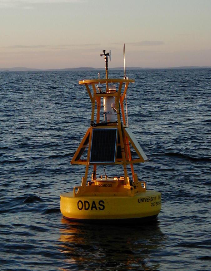 http://gyre.umeoce.maine.edu/images/gomoosbuoy.jpg http://gyre.umeoce.maine.edu/images/gomoosbuoy.jpg
|
| attribute | NC_GLOBAL | station_type | String | Surface Mooring |
| attribute | NC_GLOBAL | summary | String | University of Maine real-time buoy observations in the Gulf of Maine/Massachusetts Bay at NERACOOS site M01, located at 43d 29.442m N, 67d 52.788m W south of Gloucester. NERACOOS buoy M0127 was deployed from 2017-06-28 19:05:00 until 2018-07-09 12:11:00 UTC. Oceanographic measurements of temperature and dissolved oxygen at a depth of 200 meters were taken hourly. |
| attribute | NC_GLOBAL | time_coverage_duration | String | P375DT16H59M60.00S |
| attribute | NC_GLOBAL | time_coverage_end | String | 2025-09-17T09:00:00Z |
| attribute | NC_GLOBAL | time_coverage_resolution | String | PT60M |
| attribute | NC_GLOBAL | time_coverage_start | String | 2003-07-09T04:00:00Z |
| attribute | NC_GLOBAL | time_deployed | String | 2017-06-28T19:05Zs |
| attribute | NC_GLOBAL | time_recovered | String | 2018-07-09T12:11Zs |
| attribute | NC_GLOBAL | time_zone | String | UTC |
| attribute | NC_GLOBAL | title | String | M01 Ocean - 200 meter |
| attribute | NC_GLOBAL | uuid | String | 69474467-62b6-4af4-a4e8-b9db789c1d50 |
| attribute | NC_GLOBAL | Westernmost_Easting | double | -67.9 |
| attribute | NC_GLOBAL | wmo_platform_code | String | 44037 |
| variable | station | String | ||
| attribute | station | cf_role | String | timeseries_id |
| attribute | station | ioos_category | String | Identifier |
| attribute | station | long_name | String | Station M01 |
| variable | time | double | ||
| attribute | time | _CoordinateAxisType | String | Time |
| attribute | time | actual_range | double | 1.0577232E9, 1.7580996E9 |
| attribute | time | axis | String | T |
| attribute | time | calendar | String | gregorian |
| attribute | time | comment | String | Coordinate variable, nominal time of observation |
| attribute | time | epic_code | int | 624 |
| attribute | time | ioos_category | String | Time |
| attribute | time | long_name | String | Time |
| attribute | time | short_name | String | time |
| attribute | time | standard_name | String | time |
| attribute | time | standard_name_url | String | https://vocab.nerc.ac.uk/collection/P07/current/CFSN0115
|
| attribute | time | time_origin | String | 01-JAN-1970 00:00:00 |
| attribute | time | units | String | seconds since 1970-01-01T00:00:00Z |
| attribute | time | valid_range | double | 0.0, 2.147483647E9 |
| variable | longitude | float | ||
| attribute | longitude | _CoordinateAxisType | String | Lon |
| attribute | longitude | actual_range | float | -67.9, -67.8715 |
| attribute | longitude | axis | String | X |
| attribute | longitude | comment | String | Coordinate variable |
| attribute | longitude | echo | double | -67.8798 |
| attribute | longitude | epic_code | int | 502 |
| attribute | longitude | ioos_category | String | Location |
| attribute | longitude | long_name | String | Longitude in decimal degrees east |
| attribute | longitude | modulo | double | 360.0 |
| attribute | longitude | short_name | String | lon |
| attribute | longitude | standard_name | String | longitude |
| attribute | longitude | standard_name_url | String | https://vocab.nerc.ac.uk/collection/P07/current/CFSN0554
|
| attribute | longitude | units | String | degrees_east |
| attribute | longitude | valid_range | float | -180.0, 180.0 |
| variable | latitude | float | ||
| attribute | latitude | _CoordinateAxisType | String | Lat |
| attribute | latitude | actual_range | float | 43.4818, 43.4985 |
| attribute | latitude | axis | String | Y |
| attribute | latitude | comment | String | Coordinate variable |
| attribute | latitude | echo | double | 43.4907 |
| attribute | latitude | epic_code | int | 500 |
| attribute | latitude | ioos_category | String | Location |
| attribute | latitude | long_name | String | Latitude in decimal degrees north |
| attribute | latitude | short_name | String | lat |
| attribute | latitude | standard_name | String | latitude |
| attribute | latitude | standard_name_url | String | https://vocab.nerc.ac.uk/collection/P07/current/CFSN0600
|
| attribute | latitude | units | String | degrees_north |
| attribute | latitude | valid_range | float | -90.0, 90.0 |
| variable | depth | double | ||
| attribute | depth | _CoordinateAxisType | String | Height |
| attribute | depth | _CoordinateZisPositive | String | down |
| attribute | depth | actual_range | double | 200.0, 200.0 |
| attribute | depth | axis | String | Z |
| attribute | depth | comment | String | Coordinate variable |
| attribute | depth | echo | double | 1.0 |
| attribute | depth | epic_code | int | 3 |
| attribute | depth | ioos_category | String | Location |
| attribute | depth | long_name | String | Depth |
| attribute | depth | positive | String | down |
| attribute | depth | short_name | String | D |
| attribute | depth | standard_name | String | depth |
| attribute | depth | standard_name_url | String | https://vocab.nerc.ac.uk/collection/P07/current/CFSN0721
|
| attribute | depth | units | String | m |
| attribute | depth | valid_range | double | -1.0, 350.0 |
| variable | deployment | String | ||
| attribute | deployment | comment | String | Deployment refers to a specific mooring deployed at a station (site location) |
| attribute | deployment | goes_platform_id | String | 0442264C |
| attribute | deployment | long_name | String | M0127: Jordan Basin |
| attribute | deployment | mooring_id | String | M0127 |
| attribute | deployment | mooring_type | String | Slack |
| attribute | deployment | platform_photo_url | String | http://gyre.umeoce.maine.edu/images/gomoosbuoy.jpg
|
| attribute | deployment | short_name | String | plat |
| attribute | deployment | uscg_light_list | String | M |
| attribute | deployment | uscg_light_list_number | String | 6 |
| attribute | deployment | watch_circle_radius | int | 55 |
| attribute | deployment | water_depth | double | 285.0 |
| variable | conductivity | float | ||
| attribute | conductivity | _FillValue | float | -999.0 |
| attribute | conductivity | accuracy | double | 0.01 |
| attribute | conductivity | actual_range | float | 24.485, 38.5807 |
| attribute | conductivity | ancillary_variables | String | conductivity_qc conductivity_qc_agg conductivity_qc_tests data_source |
| attribute | conductivity | cell_methods | String | time: point |
| attribute | conductivity | comment | String | Measured by SBE37IM |
| attribute | conductivity | computed_by | String | instrument |
| attribute | conductivity | coordinates | String | time depth lat lon station actual_time time_modified time_processed |
| attribute | conductivity | coverage_content_type | String | physicalMeasurement |
| attribute | conductivity | epic_code | int | 51 |
| attribute | conductivity | grid_mapping | String | crs |
| attribute | conductivity | gts_ingest | String | True |
| attribute | conductivity | instrument | String | instrument_1 |
| attribute | conductivity | instrument_range | double | 0.0, 60.0 |
| attribute | conductivity | ioos_category | String | physical_oceanography |
| attribute | conductivity | is_dead | double | 0.0 |
| attribute | conductivity | is_off_station | double | 0.0 |
| attribute | conductivity | long_name | String | Conductivity |
| attribute | conductivity | missing_value | float | -999.0 |
| attribute | conductivity | ncei_name | String | WATER CONDUCTIVITY |
| attribute | conductivity | platform | String | station |
| attribute | conductivity | references | String | http://www.seabird.com/sbe37im-microcat-ctd
|
| attribute | conductivity | resolution | double | 0.001 |
| attribute | conductivity | short_name | String | COND |
| attribute | conductivity | source | String | buoy subsurface observation |
| attribute | conductivity | standard_name | String | sea_water_electrical_conductivity |
| attribute | conductivity | standard_name_url | String | https://vocab.nerc.ac.uk/collection/P07/current/CFSN0394
|
| attribute | conductivity | units | String | mS cm-1 |
| attribute | conductivity | valid_range | float | 15.0, 60.0 |
| variable | salinity | float | ||
| attribute | salinity | _FillValue | float | -999.0 |
| attribute | salinity | accuracy | double | 0.01 |
| attribute | salinity | actual_range | float | 22.330507, 34.897118 |
| attribute | salinity | ancillary_variables | String | salinity_qc salinity_qc_agg salinity_qc_tests data_source |
| attribute | salinity | cell_methods | String | time: point |
| attribute | salinity | comment | String | Computed using SW_SALT |
| attribute | salinity | computed_by | String | shore |
| attribute | salinity | coordinates | String | time depth lat lon station actual_time time_modified time_processed |
| attribute | salinity | coverage_content_type | String | physicalMeasurement |
| attribute | salinity | epic_code | int | 41 |
| attribute | salinity | grid_mapping | String | crs |
| attribute | salinity | gts_ingest | String | true |
| attribute | salinity | instrument | String | instrument_1 |
| attribute | salinity | instrument_range | double | 0.0, 60.0 |
| attribute | salinity | ioos_category | String | salinity |
| attribute | salinity | is_dead | double | 0.0 |
| attribute | salinity | is_off_station | double | 0.0 |
| attribute | salinity | long_name | String | Salinity |
| attribute | salinity | missing_value | float | -999.0 |
| attribute | salinity | ncei_name | String | SALINITY |
| attribute | salinity | platform | String | station |
| attribute | salinity | references | String | http://www.marine.csiro.au/~mansbrid/local_use/toolbox_local/seawater/1.seawater/index.html
|
| attribute | salinity | resolution | double | 0.001 |
| attribute | salinity | short_name | String | SAL |
| attribute | salinity | source | String | buoy subsurface observation |
| attribute | salinity | standard_name | String | sea_water_practical_salinity |
| attribute | salinity | standard_name_url | String | https://vocab.nerc.ac.uk/collection/P07/current/CFSN0331
|
| attribute | salinity | units | String | 0.001 |
| attribute | salinity | valid_range | float | 15.0, 37.0 |
| variable | sigma_t | float | ||
| attribute | sigma_t | _FillValue | float | -999.0 |
| attribute | sigma_t | accuracy | double | 0.01 |
| attribute | sigma_t | actual_range | float | 17.281284, 26.924213 |
| attribute | sigma_t | ancillary_variables | String | sigma_t_qc sigma_t_qc_agg sigma_t_qc_tests data_source |
| attribute | sigma_t | cell_methods | String | time: point |
| attribute | sigma_t | comment | String | Computed using SW_SIGT0 |
| attribute | sigma_t | computed_by | String | shore |
| attribute | sigma_t | coordinates | String | time depth lat lon station actual_time time_modified time_processed |
| attribute | sigma_t | coverage_content_type | String | physicalMeasurement |
| attribute | sigma_t | epic_code | int | 70 |
| attribute | sigma_t | grid_mapping | String | crs |
| attribute | sigma_t | instrument | String | instrument_1 |
| attribute | sigma_t | instrument_range | double | 0.0, 40.0 |
| attribute | sigma_t | ioos_category | String | physical_oceanography |
| attribute | sigma_t | is_dead | double | 0.0 |
| attribute | sigma_t | is_off_station | double | 0.0 |
| attribute | sigma_t | long_name | String | Sigma_t |
| attribute | sigma_t | missing_value | float | -999.0 |
| attribute | sigma_t | ncei_name | String | DENSITY |
| attribute | sigma_t | platform | String | station |
| attribute | sigma_t | references | String | http://www.marine.csiro.au/~mansbrid/local_use/toolbox_local/seawater/1.seawater/index.html
|
| attribute | sigma_t | resolution | double | 0.001 |
| attribute | sigma_t | short_name | String | SIGT |
| attribute | sigma_t | source | String | buoy subsurface observation |
| attribute | sigma_t | standard_name | String | sea_water_density |
| attribute | sigma_t | standard_name_url | String | https://vocab.nerc.ac.uk/collection/P07/current/CFSN0332
|
| attribute | sigma_t | units | String | kg m-3 |
| attribute | sigma_t | valid_range | float | 10.0, 30.0 |
| variable | temperature | float | ||
| attribute | temperature | _FillValue | float | -999.0 |
| attribute | temperature | accuracy | double | 0.005 |
| attribute | temperature | actual_range | float | 5.5726, 20.0 |
| attribute | temperature | ancillary_variables | String | temperature_qc temperature_qc_agg temperature_qc_tests data_source |
| attribute | temperature | cell_methods | String | time: point |
| attribute | temperature | comment | String | Measured by SBE37IM |
| attribute | temperature | computed_by | String | instrument |
| attribute | temperature | coordinates | String | time depth lat lon station actual_time time_modified time_processed |
| attribute | temperature | coverage_content_type | String | physicalMeasurement |
| attribute | temperature | epic_code | int | 20 |
| attribute | temperature | grid_mapping | String | crs |
| attribute | temperature | gts_ingest | String | true |
| attribute | temperature | instrument | String | instrument_1 |
| attribute | temperature | instrument_range | double | -5.0, 40.0 |
| attribute | temperature | ioos_category | String | temperature |
| attribute | temperature | is_dead | double | 0.0 |
| attribute | temperature | is_off_station | double | 0.0 |
| attribute | temperature | long_name | String | Temperature |
| attribute | temperature | missing_value | float | -999.0 |
| attribute | temperature | ncei_name | String | WATER TEMPERATURE |
| attribute | temperature | platform | String | station |
| attribute | temperature | references | String | http://www.seabird.com/sbe37Im-microcat-ctd
|
| attribute | temperature | resolution | double | 0.001 |
| attribute | temperature | short_name | String | WT |
| attribute | temperature | source | String | buoy subsurface observation |
| attribute | temperature | standard_name | String | sea_water_temperature |
| attribute | temperature | standard_name_url | String | https://vocab.nerc.ac.uk/collection/P07/current/CFSN0335
|
| attribute | temperature | units | String | degree_Celsius |
| attribute | temperature | valid_range | float | -2.0, 32.0 |
| variable | actual_time | double | ||
| attribute | actual_time | actual_range | double | 1.057725E9, 1.7580996E9 |
| attribute | actual_time | calendar | String | gregorian |
| attribute | actual_time | comment | String | auxiliary coordinate variable, may differ slightly from regularly spaced nominal time |
| attribute | actual_time | epic_code | int | 624 |
| attribute | actual_time | ioos_category | String | Time |
| attribute | actual_time | long_name | String | Actual time of observation |
| attribute | actual_time | short_name | String | AC_TIME |
| attribute | actual_time | time_origin | String | 01-JAN-1970 00:00:00 |
| attribute | actual_time | units | String | seconds since 1970-01-01T00:00:00Z |
| attribute | actual_time | valid_range | double | 0.0, 2.147483647E9 |
| variable | time_modified | double | ||
| attribute | time_modified | actual_range | double | 1.153175213E9, 1.770690066E9 |
| attribute | time_modified | calendar | String | julian |
| attribute | time_modified | comment | String | time of last update to record |
| attribute | time_modified | ioos_category | String | Time |
| attribute | time_modified | long_name | String | Time Record Last Modified |
| attribute | time_modified | short_name | String | time_mod |
| attribute | time_modified | time_origin | String | 01-JAN-1970 00:00:00 |
| attribute | time_modified | units | String | seconds since 1970-01-01T00:00:00Z |
| attribute | time_modified | valid_range | double | 0.0, 2.147483647E9 |
| variable | crs | double | ||
| attribute | crs | actual_range | double | 9.969209968386869E36, 9.969209968386869E36 |
| attribute | crs | epsg_code | String | EPSG:4326 |
| attribute | crs | grid_mapping_name | String | latitude_longitude |
| attribute | crs | inverse_flattening | double | 298.257223563 |
| attribute | crs | long_name | String | coordinate_reference_system |
| attribute | crs | longitude_of_prime_meridian | double | 0.0 |
| attribute | crs | semi_major_axis | double | 6378137.0 |
| variable | data_source | byte | ||
| attribute | data_source | _FillValue | byte | -128 |
| attribute | data_source | actual_range | byte | 0, 30 |
| attribute | data_source | comment | String | Source of each record of data |
| attribute | data_source | flag_meanings | String | missing goes_realtime realtime post-recovery post-calibration |
| attribute | data_source | flag_values | byte | 0, 10, 20, 30, 40 |
| attribute | data_source | long_name | String | Source of data for each record |
| attribute | data_source | missing_value | byte | -128 |
| attribute | data_source | short_name | String | DATASRC |
| attribute | data_source | units | String | 1 |
| attribute | data_source | valid_range | byte | 0, 100 |
| variable | instrument_1 | byte | ||
| attribute | instrument_1 | actual_range | byte | -127, -127 |
| attribute | instrument_1 | averaging_period | int | 4 |
| attribute | instrument_1 | averaging_period_units | String | seconds |
| attribute | instrument_1 | clock_time | String | Center of period |
| attribute | instrument_1 | comment | String | CT Sensor |
| attribute | instrument_1 | component | String | CTD,@(sbe_200_manufacturer)s,@(sbe_200_sn)s |
| attribute | instrument_1 | id | String | urn:ioos:sensor:edu.maine.umeoce:M0127:CTD,@(sbe_200_manufacturer)s,@(sbe_200_sn)s |
| attribute | instrument_1 | last_calibration_date | String | 2016-02-17 |
| attribute | instrument_1 | last_calibration_facility | String | Sea-Bird_Electronics,_Inc |
| attribute | instrument_1 | long_name | String | Conductivity Temperature Sensor (CTD) |
| attribute | instrument_1 | make_model | String | @(sbe_200_manufacturer)s,@(sbe_200_model)s |
| attribute | instrument_1 | manufacturer | String | @(sbe_200_manufacturer)s |
| attribute | instrument_1 | model | String | @(sbe_200_model)s |
| attribute | instrument_1 | ncei_name | String | CTD |
| attribute | instrument_1 | number_samples_per_observation | int | 4 |
| attribute | instrument_1 | serial_number | String | @(sbe_200_sn)s |
| attribute | instrument_1 | short_name | String | IM |
| variable | conductivity_qc | byte | ||
| attribute | conductivity_qc | _FillValue | byte | -128 |
| attribute | conductivity_qc | actual_range | byte | 0, 99 |
| attribute | conductivity_qc | comment | String | original QC quality flag |
| attribute | conductivity_qc | coordinates | String | time depth lat lon station actual_time time_modified time_processed |
| attribute | conductivity_qc | flag_meanings | String | quality_good out_of_range sensor_non_functional off_station manually_flagged |
| attribute | conductivity_qc | flag_values | byte | 0, 1, 2, 60, 99 |
| attribute | conductivity_qc | intent | String | data_quality |
| attribute | conductivity_qc | long_name | String | Conductivity QC |
| attribute | conductivity_qc | missing_value | byte | -128 |
| attribute | conductivity_qc | short_name | String | CONDQC |
| attribute | conductivity_qc | standard_name | String | quality_flag |
| attribute | conductivity_qc | valid_range | byte | -127, 127 |
| variable | conductivity_qc_agg | byte | ||
| attribute | conductivity_qc_agg | _FillValue | byte | -128 |
| attribute | conductivity_qc_agg | actual_range | byte | 1, 9 |
| attribute | conductivity_qc_agg | comment | String | QARTOD QC flag |
| attribute | conductivity_qc_agg | coordinates | String | time depth lat lon station actual_time time_modified time_processed |
| attribute | conductivity_qc_agg | flag_meanings | String | PASS NOT_EVALUATED SUSPECT FAIL MISSING |
| attribute | conductivity_qc_agg | flag_values | byte | 1, 2, 3, 4, 9 |
| attribute | conductivity_qc_agg | intent | String | data_quality |
| attribute | conductivity_qc_agg | ioos_category | String | quality |
| attribute | conductivity_qc_agg | long_name | String | conductivity QARTOD Aggregate Flag |
| attribute | conductivity_qc_agg | missing_value | byte | -128 |
| attribute | conductivity_qc_agg | references | String | https://oceandata.umeoce.maine.edu/doc/qc_references.html
|
| attribute | conductivity_qc_agg | short_name | String | CONDQAG |
| attribute | conductivity_qc_agg | standard_name | String | quality_flag |
| variable | salinity_qc | byte | ||
| attribute | salinity_qc | _FillValue | byte | -128 |
| attribute | salinity_qc | actual_range | byte | 0, 99 |
| attribute | salinity_qc | comment | String | original QC quality flag |
| attribute | salinity_qc | coordinates | String | time depth lat lon station actual_time time_modified time_processed |
| attribute | salinity_qc | flag_meanings | String | quality_good out_of_range sensor_non_functional off_station manually_flagged |
| attribute | salinity_qc | flag_values | byte | 0, 1, 2, 60, 99 |
| attribute | salinity_qc | intent | String | data_quality |
| attribute | salinity_qc | long_name | String | Salinity QC |
| attribute | salinity_qc | missing_value | byte | -128 |
| attribute | salinity_qc | short_name | String | SALQC |
| attribute | salinity_qc | standard_name | String | quality_flag |
| attribute | salinity_qc | valid_range | byte | -127, 127 |
| variable | salinity_qc_agg | byte | ||
| attribute | salinity_qc_agg | _FillValue | byte | -128 |
| attribute | salinity_qc_agg | actual_range | byte | 1, 9 |
| attribute | salinity_qc_agg | comment | String | QARTOD QC flag |
| attribute | salinity_qc_agg | coordinates | String | time depth lat lon station actual_time time_modified time_processed |
| attribute | salinity_qc_agg | flag_meanings | String | PASS NOT_EVALUATED SUSPECT FAIL MISSING |
| attribute | salinity_qc_agg | flag_values | byte | 1, 2, 3, 4, 9 |
| attribute | salinity_qc_agg | intent | String | data_quality |
| attribute | salinity_qc_agg | ioos_category | String | quality |
| attribute | salinity_qc_agg | long_name | String | salinity QARTOD Aggregate Flag |
| attribute | salinity_qc_agg | missing_value | byte | -128 |
| attribute | salinity_qc_agg | references | String | https://oceandata.umeoce.maine.edu/doc/qc_references.html
|
| attribute | salinity_qc_agg | short_name | String | SALQAG |
| attribute | salinity_qc_agg | standard_name | String | quality_flag |
| variable | sigma_t_qc | byte | ||
| attribute | sigma_t_qc | _FillValue | byte | -128 |
| attribute | sigma_t_qc | actual_range | byte | 0, 99 |
| attribute | sigma_t_qc | comment | String | original QC quality flag |
| attribute | sigma_t_qc | coordinates | String | time depth lat lon station actual_time time_modified time_processed |
| attribute | sigma_t_qc | flag_meanings | String | quality_good out_of_range sensor_non_functional off_station manually_flagged |
| attribute | sigma_t_qc | flag_values | byte | 0, 1, 2, 60, 99 |
| attribute | sigma_t_qc | intent | String | data_quality |
| attribute | sigma_t_qc | long_name | String | Sigma_t QC |
| attribute | sigma_t_qc | missing_value | byte | -128 |
| attribute | sigma_t_qc | short_name | String | SIGTQC |
| attribute | sigma_t_qc | standard_name | String | quality_flag |
| attribute | sigma_t_qc | valid_range | byte | -127, 127 |
| variable | sigma_t_qc_agg | byte | ||
| attribute | sigma_t_qc_agg | _FillValue | byte | -128 |
| attribute | sigma_t_qc_agg | actual_range | byte | 1, 9 |
| attribute | sigma_t_qc_agg | comment | String | QARTOD QC flag |
| attribute | sigma_t_qc_agg | coordinates | String | time depth lat lon station actual_time time_modified time_processed |
| attribute | sigma_t_qc_agg | flag_meanings | String | PASS NOT_EVALUATED SUSPECT FAIL MISSING |
| attribute | sigma_t_qc_agg | flag_values | byte | 1, 2, 3, 4, 9 |
| attribute | sigma_t_qc_agg | intent | String | data_quality |
| attribute | sigma_t_qc_agg | ioos_category | String | quality |
| attribute | sigma_t_qc_agg | long_name | String | sigma_t QARTOD Aggregate Flag |
| attribute | sigma_t_qc_agg | missing_value | byte | -128 |
| attribute | sigma_t_qc_agg | references | String | https://oceandata.umeoce.maine.edu/doc/qc_references.html
|
| attribute | sigma_t_qc_agg | short_name | String | SIGTQAG |
| attribute | sigma_t_qc_agg | standard_name | String | quality_flag |
| variable | temperature_qc | byte | ||
| attribute | temperature_qc | _FillValue | byte | -128 |
| attribute | temperature_qc | actual_range | byte | 0, 99 |
| attribute | temperature_qc | comment | String | original QC quality flag |
| attribute | temperature_qc | coordinates | String | time depth lat lon station actual_time time_modified time_processed |
| attribute | temperature_qc | flag_meanings | String | quality_good out_of_range sensor_non_functional off_station manually_flagged |
| attribute | temperature_qc | flag_values | byte | 0, 1, 2, 60, 99 |
| attribute | temperature_qc | intent | String | data_quality |
| attribute | temperature_qc | long_name | String | Temperature QC |
| attribute | temperature_qc | missing_value | byte | -128 |
| attribute | temperature_qc | short_name | String | WTQC |
| attribute | temperature_qc | standard_name | String | quality_flag |
| attribute | temperature_qc | valid_range | byte | -127, 127 |
| variable | temperature_qc_agg | byte | ||
| attribute | temperature_qc_agg | _FillValue | byte | -128 |
| attribute | temperature_qc_agg | actual_range | byte | 1, 9 |
| attribute | temperature_qc_agg | comment | String | QARTOD QC flag |
| attribute | temperature_qc_agg | coordinates | String | time depth lat lon station actual_time time_modified time_processed |
| attribute | temperature_qc_agg | flag_meanings | String | PASS NOT_EVALUATED SUSPECT FAIL MISSING |
| attribute | temperature_qc_agg | flag_values | byte | 1, 2, 3, 4, 9 |
| attribute | temperature_qc_agg | intent | String | data_quality |
| attribute | temperature_qc_agg | ioos_category | String | quality |
| attribute | temperature_qc_agg | long_name | String | temperature QARTOD Aggregate Flag |
| attribute | temperature_qc_agg | missing_value | byte | -128 |
| attribute | temperature_qc_agg | references | String | https://oceandata.umeoce.maine.edu/doc/qc_references.html
|
| attribute | temperature_qc_agg | short_name | String | WTQAG |
| attribute | temperature_qc_agg | standard_name | String | quality_flag |
| variable | conductivity_qc_tests | String | ||
| attribute | conductivity_qc_tests | comments | String | 14-character array with results of individual QARTOD tests. 1:Gap, 2:Syntax, 3:Location, 4:Gross Range, 5:Climatology, 6:Spike, 7:Rate of Change, 8:Flat-line, 9:Multi-variate, 10:Attenuated Signal, 11:Neighbor, 12:Associated variable, 13:Manual, 14:Other |
| attribute | conductivity_qc_tests | coordinates | String | time depth lat lon station actual_time time_modified time_processed |
| attribute | conductivity_qc_tests | flag_meanings | String | PASS NOT_EVALUATED SUSPECT FAIL MISSING |
| attribute | conductivity_qc_tests | flag_values | String | 1, 2, 3, 4, 9 |
| attribute | conductivity_qc_tests | intent | String | data_quality |
| attribute | conductivity_qc_tests | ioos_category | String | quality |
| attribute | conductivity_qc_tests | long_name | String | conductivity QARTOD Individual Tests |
| attribute | conductivity_qc_tests | short_name | String | CONDQTST |
| attribute | conductivity_qc_tests | standard_name | String | quality_flag |
| variable | salinity_qc_tests | String | ||
| attribute | salinity_qc_tests | comments | String | 14-character array with results of individual QARTOD tests. 1:Gap, 2:Syntax, 3:Location, 4:Gross Range, 5:Climatology, 6:Spike, 7:Rate of Change, 8:Flat-line, 9:Multi-variate, 10:Attenuated Signal, 11:Neighbor, 12:Associated variable, 13:Manual, 14:Other |
| attribute | salinity_qc_tests | coordinates | String | time depth lat lon station actual_time time_modified time_processed |
| attribute | salinity_qc_tests | flag_meanings | String | PASS NOT_EVALUATED SUSPECT FAIL MISSING |
| attribute | salinity_qc_tests | flag_values | String | 1, 2, 3, 4, 9 |
| attribute | salinity_qc_tests | intent | String | data_quality |
| attribute | salinity_qc_tests | ioos_category | String | quality |
| attribute | salinity_qc_tests | long_name | String | salinity QARTOD Individual Tests |
| attribute | salinity_qc_tests | short_name | String | SALQTST |
| attribute | salinity_qc_tests | standard_name | String | quality_flag |
| variable | sigma_t_qc_tests | String | ||
| attribute | sigma_t_qc_tests | comments | String | 14-character array with results of individual QARTOD tests. 1:Gap, 2:Syntax, 3:Location, 4:Gross Range, 5:Climatology, 6:Spike, 7:Rate of Change, 8:Flat-line, 9:Multi-variate, 10:Attenuated Signal, 11:Neighbor, 12:Associated variable, 13:Manual, 14:Other |
| attribute | sigma_t_qc_tests | coordinates | String | time depth lat lon station actual_time time_modified time_processed |
| attribute | sigma_t_qc_tests | flag_meanings | String | PASS NOT_EVALUATED SUSPECT FAIL MISSING |
| attribute | sigma_t_qc_tests | flag_values | String | 1, 2, 3, 4, 9 |
| attribute | sigma_t_qc_tests | intent | String | data_quality |
| attribute | sigma_t_qc_tests | ioos_category | String | quality |
| attribute | sigma_t_qc_tests | long_name | String | sigma_t QARTOD Individual Tests |
| attribute | sigma_t_qc_tests | short_name | String | SIGTQTST |
| attribute | sigma_t_qc_tests | standard_name | String | quality_flag |
| variable | temperature_qc_tests | String | ||
| attribute | temperature_qc_tests | comments | String | 14-character array with results of individual QARTOD tests. 1:Gap, 2:Syntax, 3:Location, 4:Gross Range, 5:Climatology, 6:Spike, 7:Rate of Change, 8:Flat-line, 9:Multi-variate, 10:Attenuated Signal, 11:Neighbor, 12:Associated variable, 13:Manual, 14:Other |
| attribute | temperature_qc_tests | coordinates | String | time depth lat lon station actual_time time_modified time_processed |
| attribute | temperature_qc_tests | flag_meanings | String | PASS NOT_EVALUATED SUSPECT FAIL MISSING |
| attribute | temperature_qc_tests | flag_values | String | 1, 2, 3, 4, 9 |
| attribute | temperature_qc_tests | intent | String | data_quality |
| attribute | temperature_qc_tests | ioos_category | String | quality |
| attribute | temperature_qc_tests | long_name | String | temperature QARTOD Individual Tests |
| attribute | temperature_qc_tests | short_name | String | WTQTST |
| attribute | temperature_qc_tests | standard_name | String | quality_flag |